


 English
The Philippine Atmospheric, Geophysical and Astronomical Services Administration (Pagasa) said in its afternoon report that a low pressure area (LPA) sighted 1,360 kilometers east of Mindanao as of 3 pm could enter the Philippine Area of Responsibility (PAR) on Sunday afternoon until evening.
Daniel James Villamil, Pagasa weather forecaster, said Saturday when it enters the PAR, it has a slim chance of becoming a typhoon in 24 hours.
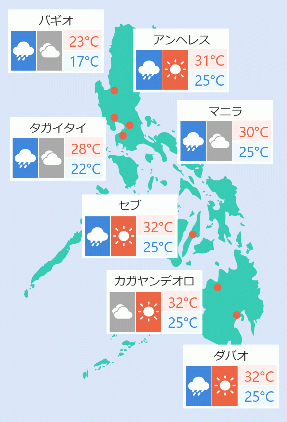
"The LPA will cause cloudy skies, rainshowers, and thunderstorms in different areas in the Philippines, particularly in Sorsogon, Masbate, Eastern Visayas, Surigao del Norte and Dinagat Island," Villamil said.
"Metro Manila and the rest of the country will expect good weather but have partly cloudy to cloudy skies with isolated rainshowers or thunderstorms in Central Luzon and the rest of Northern Luzon and other parts of the country." he added.
Cagayan Valley and Cordillera Administrative Region will experience cloudy skies with rains caused by the northeasterly surface windflow and possible flash floods or landslides due to moderate with at times heavy rains.
Eastern Visayas, Sorsogon, Masbate, Surigao del Norte, and Dinagat Islands, will expect cloudy skies with scattered rainshowers and thunderstorms due to trough of the LPA. Flash floods or landslides are possible due to moderate with at times heavy rains. Eric Acidre/DMS