

 English
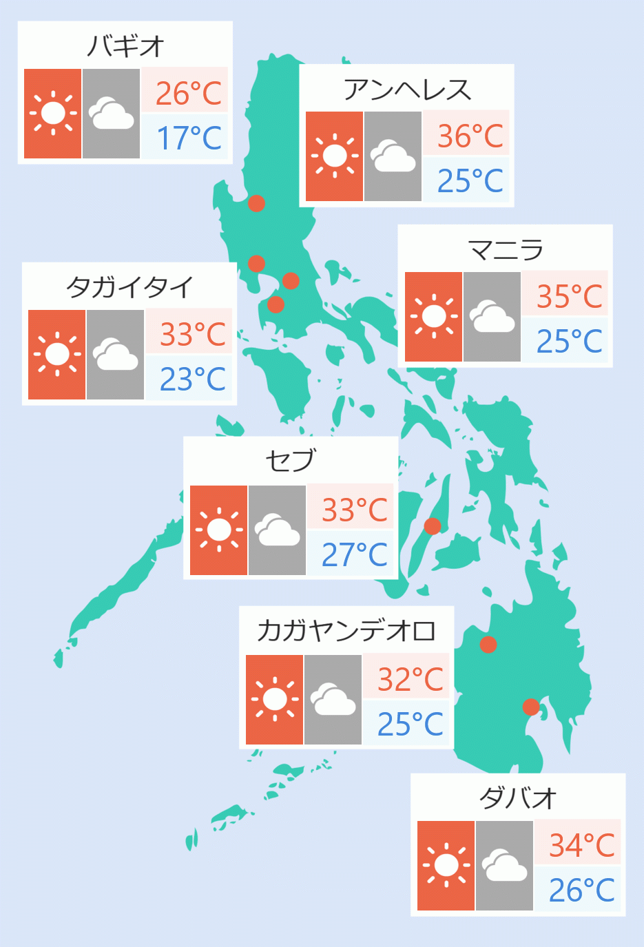
The Philippine Atmospheric, Geophysical and Astronomical Services Administration (Pagasa) on Tuesday said Tropical Storm ''Siony'' will start to move by Wednesday afternoon to Thursday afternoon and is likely to intensify into a typhoon.
In a press briefing, Pagasa Senior Weather Specialist Chris Perez said Siony was last spotted at 610 km east of Basco, Batanes.
It has maximum winds of up to 85 kph and gusts up to 105 kph.
Perez said the tropical storm will move generally westward towards extreme Northern Luzon.
“It is forecast to make landfall over Batanes-Babuyan Islands by Thursday afternoon to Friday early,” he said.
“There is also a chance that it will have an effect on some parts of Cagayan Valley… Warning signals may also be lifted in other parts of Northern Luzon as 'Siony' passes through the country,” he added.
Pagasa advised all areas in Luzon to be prepared as 'Siony' is forecast to intensify into a typhoon.
Meanwhile, Tropical Storm ''Rolly'' was last spotted 435 north-northeast of Pagasa Island and is expected to leave the Philippine Area of Responsibility (PAR) by Tuesday evening.
Perez said the combined effects of the northeasterlies and ''Siony'' will bring light to moderate with at times heavy rains over Batanes, Apayao, Cagayan, and Isabela.
The northeasterlies, enhanced by ''Rolly'', will bring strong to near gale conditions with gusts over Batanes, Babuyan Islands, and the northern portions of Cagayan and Ilocos Norte.
Flooding, including flash floods and rain-induced landslides may occur during heavy or prolonged rainfall especially in areas that are highly or very highly susceptible to these hazards. Ella Dionisio/DMS