


 English
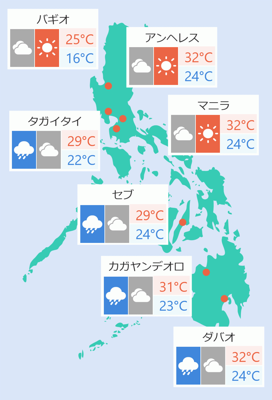
Some areas in the province of Catanduanes were placed under tropical storm wind signal number 1 as a low pressure area at the eastern waters of Bicol Region developed into a Tropical Depression ''Paolo''.
Paolo with maximum sustained winds of 55 kph near the center and gustiness of up to 70 kph was last spotted at 665km east of Virac.
The tropical depression is moving northwest at 25kph.
Parts of Catanduanes that are placed under signal number one were Pandan, Bagamanoc, Panganiban, Viga.
Based on the forecast track, Paolo may make landfall over Isabela or northern Aurora on Friday (October 3) morning or afternoon while "southward shift of track is possible depending on the strength of the high pressure area to the north of Paolo".
"It will exit the Philippine Area of Responsibility by Saturday (October 4) morning," the state weather bureau said.
"Paolo will continue to intensify while over the Philippine Sea and may reach severe tropical storm category by Friday early morning. Further intensification into a Typhoon prior to landfall is not ruled out. Re-intensification is highly likely once Paolo emerges over the West Philippine Sea," it added. Robina Asido/DMS