


 English
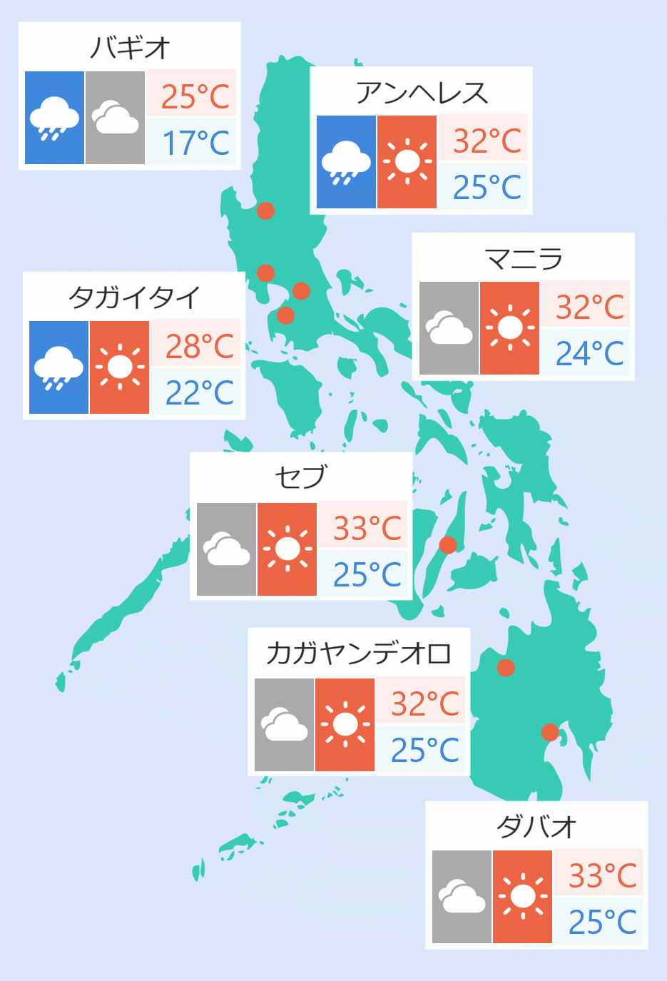
Sixteen areas in Luzon were placed under signal number one as the low pressure area (LPA) monitored inside the Philippine area of responsibility developed into Tropical Depression ''Mirasol'' on Tuesday afternoon.
Areas under tropical cyclone wind signal number one include Batanes, Cagayan including Babuyan Islands, Isabela, Quirino, the northeastern portion of Nueva Vizcaya (Diadi, Quezon, Kasibu, Dupax del Norte, Bambang, Ambaguio, Bayombong, Solano, Villaverde, Bagabag), the northern and central portions of Aurora (Dilasag, Casiguran, Dinalungan, Dipaculao, Baler), Apayao, Kalinga, Abra, Mountain Province, Ifugao, Ilocos Norte, Polillo Islands, the northern portion of Camarines Norte (Vinzons, Capalonga, Jose Panganiban, Paracale, Talisay, Daet, Mercedes), the northeastern portion of Camarines Sur (Caramoan, Garchitorena, Presentacion, Lagonoy, Siruma, Tinambac, Goa, San Jose), and Catanduanes.
''Mirasol'', last spotted at 210 km east northeast of Infanta, Quezon was moving northwest at 25kph.
According to the state weather bureau, the tropical depression has maximum sustained winds of 55 kph near the center and gustiness of up to 70 kph.
"Tropical Depression 'Mirasol' is forecast to continue moving northwestward and will slightly decelerate as it approaches Isabela-Aurora area," it stated.
"On the forecast track, the center of 'Mirasol' may make landfall in Isabela or the northern portion of Aurora by tomorrow morning. However, a more north northwestward or northward movement will likely result in no landfall scenario and will just move over the coastal waters of Northern and Central Luzon," it added.
''Mirasol'' is expected to re-emerge over Luzon strait by Thursday (Sept. 18) morning and will continue moving north northwestward until it exits the Philippine Area of Responsibility between afternoon and evening of the same day. Robina Asido/DMS