


 English
Typhoon Gorio sustained its strength as it move towards Taiwan while tropical depression Haetang has developed into tropical storm, the Philippine Geophysical and Astronomical Services Administration (Pagasa) said Saturday.
Weather forecaster Sheila Reyes said Typhoon Gorio has sustained a maximum winds of 145 kph and gusts of up to 180 kph.
Gorio was last spotted at 360 km north of Basco, Batanes, Reyes said.
Haetang is located 370 km west of Laoag City, Ilocos Norte. It may enter Philippine area of responsibility on Sunday afternoon or evening, she said.
She said Typhoon Gorio will continue to enhance the southwest monsoon which affects the western section of northern and central Luzon.
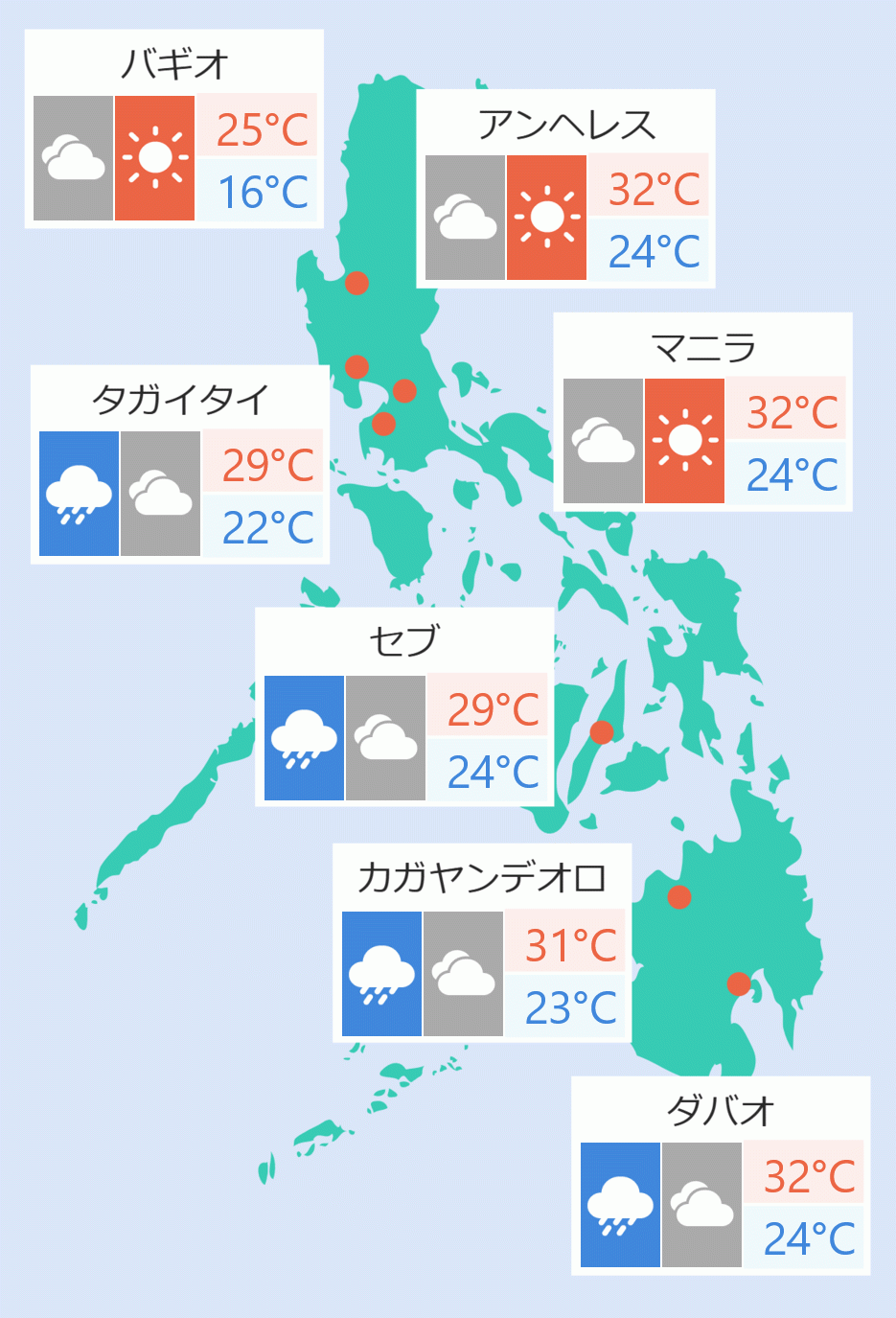
Ilocos, Cordillera, Bataan and Zambales are expected to experience monsoon rains, Reyes said.
Cloudy skies with light to moderate rains and thunderstorms are expected to be experience in the rest of central Luzon and Cagayan.
Metro Manila, the rest of Luzon ,Visayas and Mindanao will experience partly cloudy to cloudy skies with isolated rain showers or thunderstorms, she said.
Pagasa lifted Tropical Cyclone Warning Signal number one in Batanes Group of Islands. Batanes will experience rains and gusty winds.
Reyes said Typhoon Gorio is expected to make a landfall in Taiwan by 6 or 7 pm. and exit the Philippine area of responsibility on Sunday. Alanna Ambi/DMS