


 English
The Philippine Atmospheric, Geophysical and Astronomical Services Administration (Pagasa) is monitoring two low pressure areas inside and outside the Philippine Area of Responsibility.
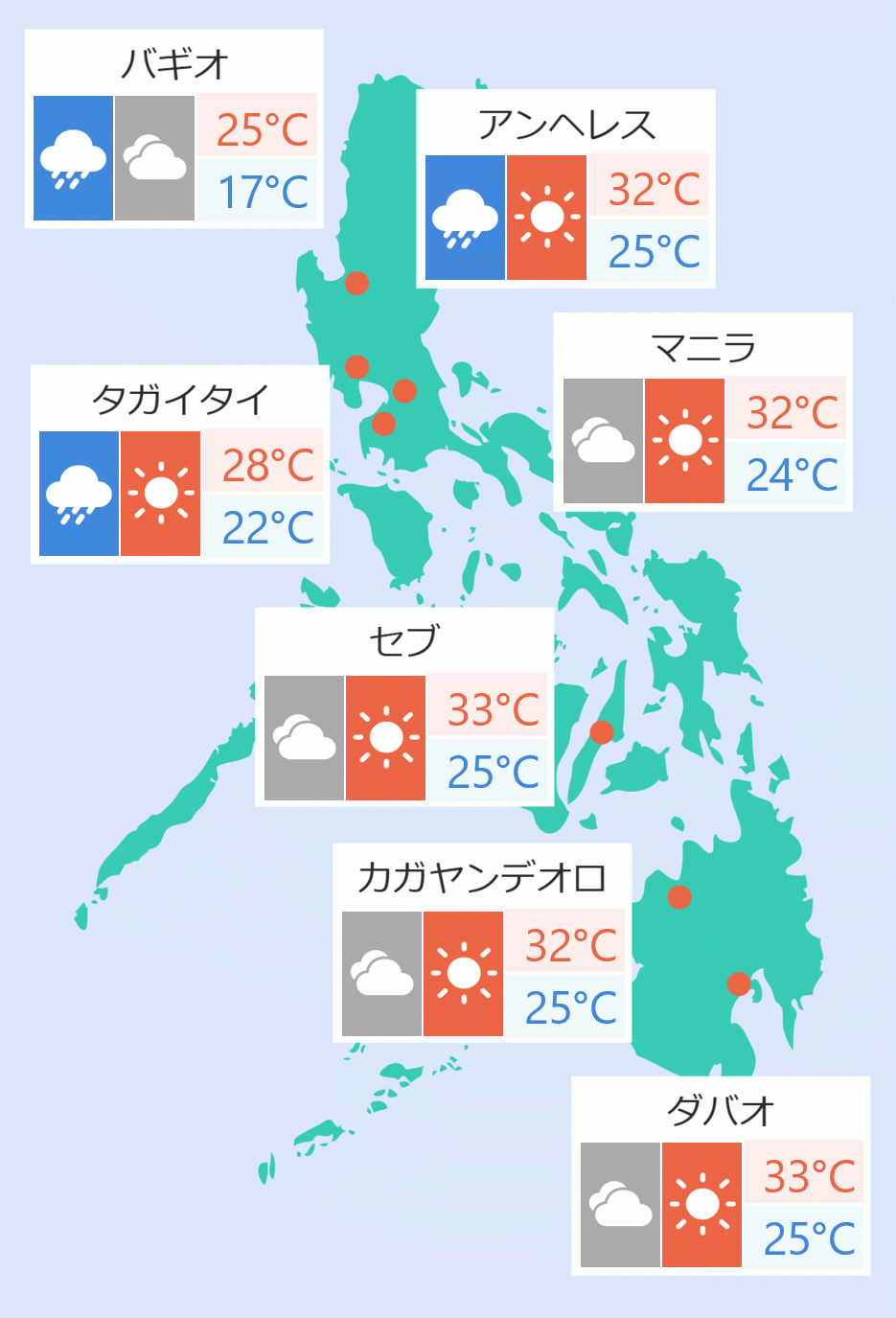
In its 4 pm bulletin Thursday, the state weather bureau said the low pressure area that has been causing rains in several parts of the country was last seen 125 kilometers east of Puerto Princesa.
It is within the Inter-Tropical Convergence Zone (ITCZ) affecting Southern Luzon, Visayas, and Mindanao.
Metro Manila and the rest of the country will experience partly cloudy to cloudy skies with isolated rainshowers or thunderstorms caused by easterlies or localized thunderstorms.
Meanwhile, Palawan, Western Visayas, Northern Samar, Eastern Samar, and Samar are expected to have cloudy skies with scattered rainshowers and thunderstorms caused by the low pressure area or the ITCZ.
Pagasa did not rule out the possibility that it could turn into a tropical depression within the next 48 hours.
The low pressure area is expected to reach Palawan and the West Philippine Sea before leaving the PAR.
During the weekend, another low pressure area is expected to enter the PAR, which was located 1,350 kilometers east of Mindanao, Pagasa said. Jaspearl Tan/DMS